
Bringing together more than 30 years of geologic and geophysical data at NASA’s White Sands Test Facility to strengthen long-term groundwater remediation decisions.
The White Sands Test Facility has supported rocket propulsion testing since 1963 and contains legacy groundwater contamination requiring long-term remediation. Understanding how contaminants move through the subsurface was essential for guiding cleanup decisions and protecting groundwater resources.
Over more than three decades, the site accumulated extensive geologic, geophysical, and groundwater data collected using different technologies, assumptions, and interpretations. While valuable, those datasets did not provide a consistent understanding of subsurface conditions.
NASA needed a unified conceptual site model that could reduce uncertainty, support groundwater modeling, inform remediation strategies, and strengthen technical engagement with regulators.
Drummond Carpenter synthesized more than three decades of geophysical and geologic investigations into a unified interpretation of the site’s subsurface structure. Our team integrated legacy datasets within a single technical framework to reduce uncertainty and establish a more consistent understanding of subsurface conditions through:
The project brought decades of independent studies together rather than treating each investigation as a separate source of information.
The resulting framework gave NASA a unified understanding of subsurface conditions that could support groundwater modeling, remediation planning, and future technical decisions.
Understanding groundwater contamination requires more than mapping where contaminants exist today. It depends on understanding how geology, groundwater flow, and subsurface structures influence where contaminants may move tomorrow.
The integrated model combined:
The resulting three-dimensional interpretation quantified contaminant plume masses, identified critical saturated zones, mapped faults and lithologic boundaries, and clarified groundwater and contaminant transport pathways that influence long-term remediation.
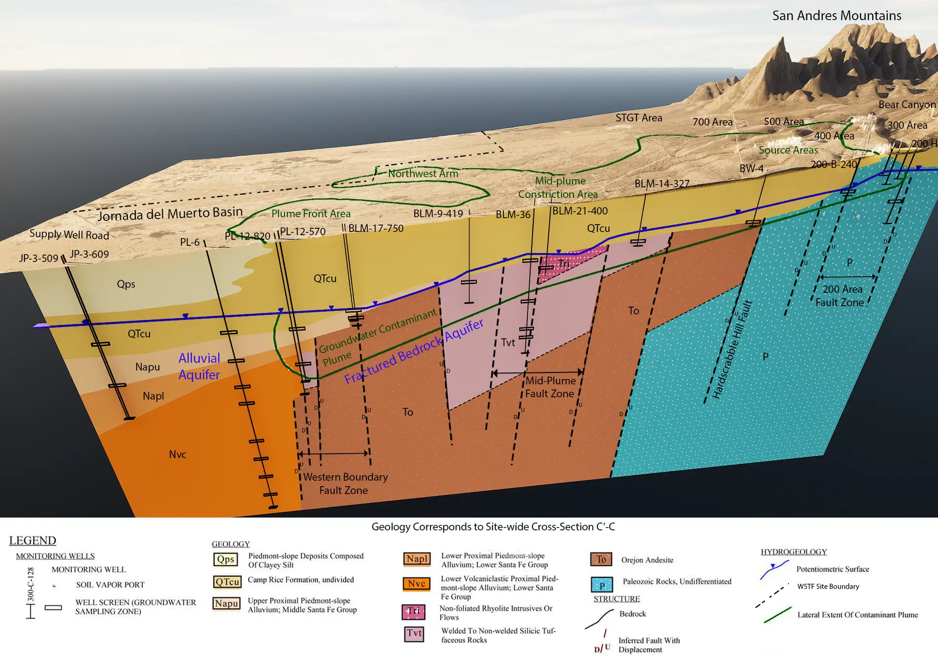
The resulting model became a foundational tool for groundwater remediation planning and long-term environmental management at the White Sands Test Facility.
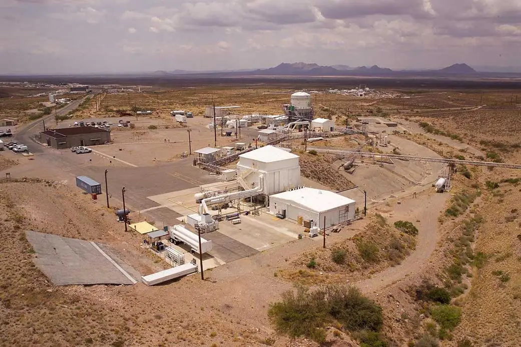
Effective groundwater remediation depends on understanding how contaminants move through complex subsurface environments. As investigations accumulate over decades, existing information can become increasingly difficult to interpret as a whole, particularly when it reflects different technologies, assumptions, and interpretations.
At White Sands Test Facility, integrating more than 30 years of geologic, geophysical, and groundwater information into a unified three-dimensional model gave NASA a more consistent understanding of subsurface conditions and a stronger technical basis for long-term groundwater remediation decisions.