Modeling flood exposure across critical assets to guide long-term resilience investments under current and future rainfall conditions.
Flood risk in Central Florida is intensifying with rapid development, aging infrastructure ,and evolving rainfall patterns. For Orange County, the challenge extended beyond individual drainage projects. County leaders needed to understand how flooding could affect critical infrastructure across jurisdictions and under future rainfall conditions.
Without a unified assessment, investment decisions risked being reactive or fragmented, with no consistent way to identify the assets most vulnerable to disruption. The County needed a data-driven framework to set priorities, support funding strategies, and strengthen long-term resilience planning.
Drummond Carpenter assessed flood vulnerability across Orange County and seven municipalities, bringing infrastructure and flood risk data into a countywide model.
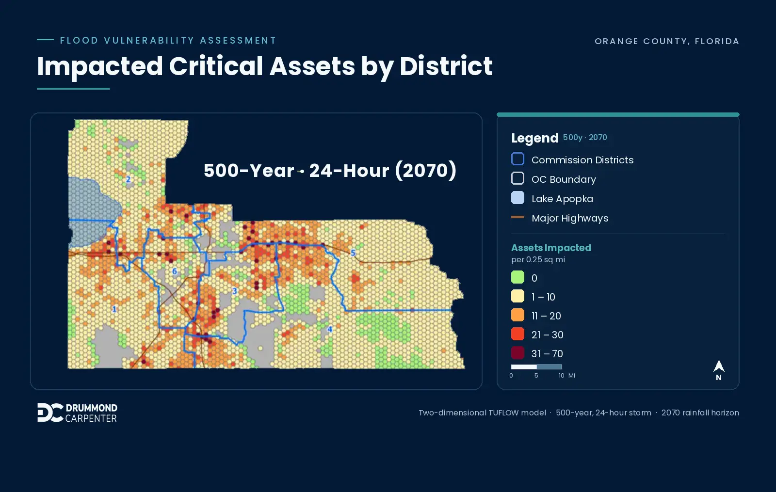
We built a two-dimensional TUFLOW High-Performance Computing model spanning approximately 900 square miles and incorporating detailed GIS data for more than 180,000 stormwater assets, including pipes, culverts, pump stations, and drainage structures.
We simulated flood depth and extent for major storm events across multiple planning horizons, capturing current conditions and projected future rainfall intensity. We then evaluated those results against inventories of critical infrastructure to determine exposure and vulnerability.
Together, the modeling and infrastructure analysis gave Orange County a consistent way to identify where critical assets face the greatest flood exposure and prioritize resilience investments accordingly.

Drummond Carpenter consolidated previously disconnected studies into a single analytical framework, allowing flood risk and system performance to be evaluated consistently across the County.
Integrated datasets included:
The unified model gives Orange County a consistent basis for evaluating capital projects rather than relying on separate analyses with varying levels of resolution. This map shows where critical assets are more frequently affected by flooding across the County.
The assessment provides a structured roadmap for reducing flood risk while protecting essential services and infrastructure.
Flood resilience planning depends on understanding how interconnected infrastructure systems will perform as rainfall conditions change over time. A countywide model gives decision-makers that broader view, showing where critical assets are exposed and providing a consistent basis for evaluating where resilience investments are needed.
By connecting flood modeling with infrastructure vulnerability across Orange County, Drummond Carpenter helped the County identify priorities and plan for future flood risk across its watershed network.